Programming- Watershed Delineation via Python
Problem Description
I wanted to combine many hydrologic processes into one convenient, packaged tool that would streamline the process of delineating watersheds and produce an output of predicted runoff from an area of interest.
Analysis Procedures
In order to accomplish this task I decided to use Python. By using Python, and more specifically the ArcPy library, I was able to incorporate many geoprocessing tasks into a single script that can be used by anyone running the ArcGIS software. The tool, “Watershed Runoff Analysis,” allow the user to input the slope, vegetation type, and soil type of a particular area, then prompts them to simulate a precipitation event and is able to calculate the amount, and location, of discharge from the area.
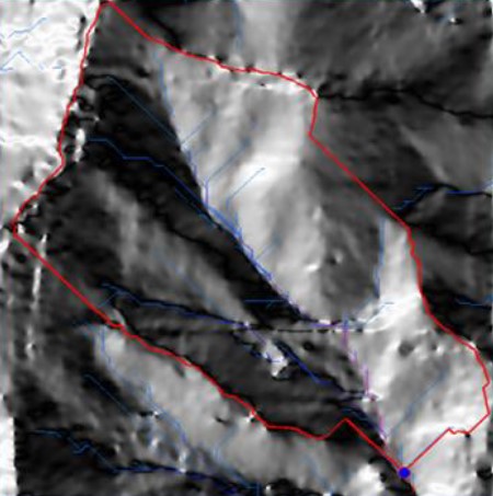
Results
Below are a pair of examples of the functionality of the tool:

Reflection
In order to make this project a reality, the appropriate first step was to learn the Python programming language. Accomplished via NCSU’s GIS540 course, I applied this new found knowledge to a topic that interested me, as well as applying it to a field I thought I could make important contributions. By creating this tool, I allowed professionals in the watershed science, forestry, and natural resources fields to save time and effort in the delineation of watershed boundaries and the determination of their approximate discharge.
This project greatly enhanced my own skills as well as giving me the opportunity to learn what I needed to work on to continue my own professional development. This is especially important because as professionals in our respective fields, we should never stop learning and, hopefully, we will never reach a point where we believe there exists no new means of discovery.
